Severe weather warning near West Coast - heavy rain
An active front is forecast to move slowly north over the South Island during Thursday and Friday, bringing heavy rain to parts of central and southern New Zealand.
This is expected to be an exceptionally heavy rainfall event for Westland with flooding and slips likely.
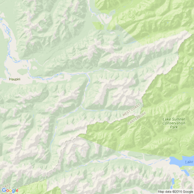
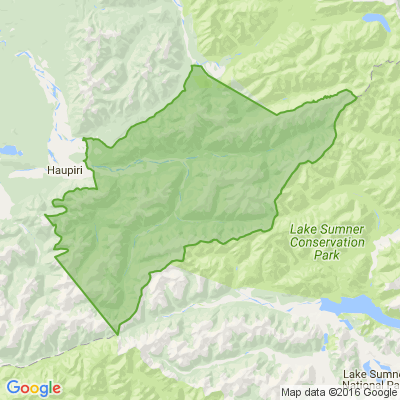
Area: Ranges of Buller and western Nelson including Nelson Lakes
Valid: 24 hours from 10:00am Thursday to 10:00am Friday
Forecast: Expect 90 to 140mm of rain to accumulate. Peak intensities of 15 to 25mm per hour especially overnight Thursday and Friday morning.
Area: Westland north of Otira
Valid: 16 hours from 9:00am Thursday to 1:00am Friday
Forecast: Expect a further 120 to 150mm of rain to accumulate about the ranges and 60 to 90mm elsewhere on top of what has already fallen. Peak intensities of 15 to 25mm per hour especially about the ranges. Thunderstorms possible.
Area: Westland south of Otira
Valid: 9 hours from 9:00am to 6:00pm Thursday
Forecast: Significant heavy rainfall and flooding likely. Expect a further 200 to 250mm of rain to accumulate about the ranges and 80 to 100mm elsewhere on top of what has already fallen. Peak intensities of 30 to 40mm per hour in thunderstorms this morning and early afternoon.

Some Choice News!
DOC is rolling out a new tool to help figure out what to tackle first when it comes to protecting our threatened species and the things putting them at risk.
Why does this matter? As Nikki Macdonald from The Post points out, we’re a country with around 4,400 threatened species. With limited time and funding, conservation has always meant making tough calls about what gets attention first.
For the first time, DOC has put real numbers around what it would take to do everything needed to properly safeguard our unique natural environment. The new BioInvest tool shows the scale of the challenge: 310,177 actions across 28,007 sites.
Now that we can see the full picture, it brings the big question into focus: how much do we, as Kiwis, truly value protecting nature — and what are we prepared to invest to make it happen?
We hope this brings a smile!

Poll: If we want to reduce speeding, what do you think actually changes driver behaviour? 🛻🚨🚓
In the Post's article on speeding penalties, the question is asked whether speeding fines are truly about road safety, or are they just a way to boost revenue for the Crown?
What do you think? Should speeding motorists receive speeding fines or demerit points?

-
37.8% The sting of a fine (Money talks!)
-
62.2% The threat of demerit points (Nobody wants to lose their license!)
Share your favourite main crop potato recipe and win a copy of our mag!
Love potatoes? We will give away free copies of the May 2026 issue to readers whose potato recipes are used in our magazine. To be in the running, make sure you email your family's favourite way to enjoy potatoes: mailbox@nzgardener.co.nz, by March 1, 2026.


 Loading…


