
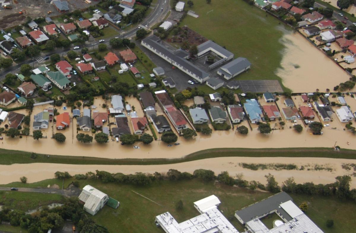
Mapping flood hazards in Lower Hutt
The most comprehensive flood mapping programme in Lower Hutt’s history is underway – but we need your help.
Draft maps of river and stormwater flood hazards have been prepared. Next week, we’ll start taking the maps to communities across the city, and we’d like people with memories or photos of past flood events to help us make the finished maps as accurate as possible.
So come along to our public information sessions and view the draft maps, learn more about natural hazards and help us to manage flood risk in our city. More information blow.
Have you got New Zealand's best shed? Show us and win!
Once again, Resene and NZ Gardener are on the hunt for New Zealand’s best shed! Send in the photos and the stories behind your man caves, she sheds, clever upcycled spaces, potty potting sheds and colourful chicken coops. The Resene Shed of the Year 2026 winner receives $1000 Resene ColorShop voucher, a $908 large Vegepod Starter Pack and a one-year subscription to NZ Gardener. To enter, tell us in writing (no more than 500 words) why your garden shed is New Zealand’s best, and send up to five high-quality photos by email to mailbox@nzgardener.co.nz. Entries close February 23, 2026.

Share your favourite main crop potato recipe and win a copy of our mag!
Love potatoes? We will give away free copies of the May 2026 issue to readers whose potato recipes are used in our magazine. To be in the running, make sure you email your family's favourite way to enjoy potatoes: mailbox@nzgardener.co.nz, by March 1, 2026.

Poll: 🤖 What skills do you think give a CV the ultimate edge in a robot-filled workplace?
The Reserve Bank has shared some pretty blunt advice: there’s no such thing as a “safe” job anymore 🛟😑
Robots are stepping into repetitive roles in factories, plants and warehouses. AI is taking care of the admin tasks that once filled many mid-level office jobs.
We want to know: As the world evolves, what skills do you think give a CV the ultimate edge in a robot-filled workplace?
Want to read more? The Press has you covered!

-
52.8% Human-centred experience and communication
-
14.8% Critical thinking
-
29.6% Resilience and adaptability
-
2.8% Other - I will share below!
 Loading…