Sinking coastlines mean parts of Christchurch will feel impact of sea-level rise earlier than expected
From reporter Tina Law:
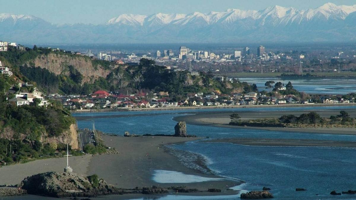
Parts of Christchurch will feel the impacts of sea-level rise earlier than expected because the land is sinking, according to new data.
Large areas from Woodend to Lake Ellesmere, including Banks Peninsula, are subsiding up to three millimetres per year, which means an extra 30 centimetres of sea-level rise over the next 100 years.
The data has come from NZ SeaRise, a five-year research programme funded by the Government involving 30 local and international experts.
It has taken into account the natural rises and falls of the country’s coastline, as well as climate change and warming temperatures to project sea level rises.
Using a www.searise.nz... |new online tool|, New Zealanders will for the first time be able to see how much and how fast sea levels will rise along their own stretch of coast and in their neighbourhood.
Programme co-leader Professor Tim Naish, of Victoria University of Wellington, said 20 years ago it was thought sea-level rise was like pouring water into a bathtub – if you put more water in, it rises uniformly around the world, but Naish said it is actually much more complicated.
Sea levels are expected to rise at different rates across New Zealand and even at different levels across Canterbury’s coastline.
The largest increases in sea levels are expected to occur along the southeast of the North Island along the Wairarapa Coast.
Programme co-leader Dr Richard Levy, of GNS Science and Victoria University of Wellington, said subsidence rates along that coast were high, and sea levels could rise by well over 1.5 metres by 2100 if the least optimistic climate change scenario was followed.
Based on current international emissions reduction policies, global sea levels are expected to rise by about 60cm by 2100, but for large parts of New Zealand this could double to about 1.2m due to ongoing land subsidence, Naish said.
“We have less time to act than we thought.”
According to the data, Akaroa on Banks Peninsula would see 30cm of sea-level rise by 2040, instead of 2060. The coastline in the area is sinking by 3mm a year.
“Thirty centimetres of sea-level rise means the one in 50-year coastal storm flood will occur annually,” Naish said.
However, some areas at the top of Lyttelton Harbour have shown a rise in the land.
Land movement data was based on median numbers taken between 2003 and 2011, and does not include the impact of the Christchurch earthquakes.
The data showed New Brighton’s coastline was sinking at 0.8mm a year, but Naish said since the earthquakes it has actually been sinking at 8mm a year, twice as fast as the global sea-level rise.
“We don’t know how long this will go on for.”
Levy said he expected councils and planners to be the primary users of the new projection information, and that the finance and insurance sectors had already been asking for the data.
Naish said the new science would give time to put in place equitable and effective adaptation measures that would limit the impact of unavoidable sea-level rise.
The Christchurch City Council has already embarked on a long process to adapt the city and Banks Peninsula to climate change.
Changes to managing new developments are being made to the district plan and the council has agreed on guidelines for adapting existing areas.
Whakaraupō Lyttelton Harbour will be the first area in Christchurch to go through climate change planning, expected to start in the spring and take 18 months.
Simon Watts, observatory director at Brighton Observatory of Environment and Economics who built his home in Southshore, said it was always better to know about things rather than be ambushed, but said the devil was always in the detail.
He said there were areas in Christchurch that rose after the earthquakes and others that sunk.
“For some areas it could be good news and others it could be bad news.
“Yes, people should be concerned because if parts of New Zealand sink by 3mm a year, that is effectively doubling the rate of sea level rise for those places."

Poll: 🤖 What skills do you think give a CV the ultimate edge in a robot-filled workplace?
The Reserve Bank has shared some pretty blunt advice: there’s no such thing as a “safe” job anymore 🛟😑
Robots are stepping into repetitive roles in factories, plants and warehouses. AI is taking care of the admin tasks that once filled many mid-level office jobs.
We want to know: As the world evolves, what skills do you think give a CV the ultimate edge in a robot-filled workplace?
Want to read more? The Press has you covered!

-
0% Human-centred experience and communication
-
0% Critical thinking
-
0% Resilience and adaptability
-
0% Other - I will share below!
Emma’s wedding dress reveal tells a different love story
A Valentine’s-inspired wedding dress show at Ryman Healthcare’s Logan Campbell Village is providing the perfect opportunity for residents to share memories of their romantic day.
But for Emma Muller, it has also turned into an opportunity to celebrate her late daughter Nicola, who died 19 years ago at the age of 37.

Poll: Should the government levy industries that contribute to financial hardship?
As reported in the Post, there’s a $30 million funding gap in financial mentoring. This has led to services closing and mentors stepping in unpaid just to keep helping people in need 🪙💰🪙
One proposed solution? Small levies on industries that profit from financial hardship — like banks, casinos, and similar companies.
So we want to hear what you think:
Should the government ask these industries to contribute?

-
59.4% Yes, supporting people is important!
-
26.4% No, individuals should take responsibility
-
14.2% ... It is complicated


 Loading…